The City walk
Follow the official Roman trail, then notice medieval lanes, churches and modern towers sharing the same small area.
Roman London trail ↗
Cultural fluency · Canadians in London
River, trade, villages, railways and rebuilding. Enough background to see the city differently on your next walk.
Roman Londinium grew beside the Thames in the area now called the City of London. Trade, a river crossing and connections to the wider Roman world made the location valuable. Surviving wall fragments and the amphitheatre beneath Guildhall help put the ancient city back on the modern map.
Westminster developed to the west around royal and religious power. Edward the Confessor’s palace and abbey helped establish that centre; Parliament’s history grew around the palace. London’s commercial and political centres therefore have different roots.
Today “the City” can mean the Square Mile or, more broadly, the financial sector. Westminster can mean the district or national politics. Neither means all of London.
The Great Fire began in September 1666 and devastated much of the City. Rebuilding changed construction and produced the new St Paul’s Cathedral and many City churches associated with Christopher Wren.
Wren proposed a grand new street plan, but it was never adopted. Coordinating the property owners and their existing plots proved a major obstacle, and rebuilding largely retained the old street pattern. That helps explain why a modern office district still contains narrow lanes, small churchyards and unexpected changes of direction.
Look for the Monument and nearby streets, then compare the scale of a churchyard with the towers around it.
The Thames was a highway for goods and people, as well as a receiver of sewage. London Bridge was the only bridge across the river in central London until Westminster Bridge opened in 1750. Boats and ferries were essential to getting around. London Museum: Westminster Bridge ↗ The Great Stink of 1858 made the consequences impossible for Parliament to ignore. Engineer Joseph Bazalgette’s sewer system intercepted waste and carried it away from central London.
The embankments are infrastructure as well as scenery. Walking beside the river, you are seeing a city reshaped to manage movement, waste and public health. John Snow’s work on cholera belongs to the same broader story of understanding how disease spread.
London expanded around existing settlements, local centres and transport routes. Places such as Hampstead and Croydon have histories that reach beyond their place in today’s metropolis. A neighbourhood high street can still act as a town centre within the larger city.
Railways made longer journeys to work possible and helped shape suburban growth. “Metro-land” promoted the landscape and housing along the Metropolitan Railway’s north-western routes. Stations and their connections remain part of how Londoners choose where to live.
For a newcomer, that means two homes the same distance from central London can offer very different daily lives. Use our railway gateways guide alongside the local high street, parks and community facilities.
The Blitz brought sustained bombing from September 1940, with the docks among the early targets. Londoners used Tube stations as shelters, among other places of refuge. Destruction, displacement and wartime loss shaped the city long after the raids ended. The December 1940 photograph known as “St Paul’s Survives” made the cathedral above the smoke an enduring image of resilience. St Paul’s: the photograph and its history ↗ · IWM: shelter life in a Tube station ↗
Post-war rebuilding produced housing estates, new roads and cultural projects. The Barbican is a striking example of redevelopment in a badly bombed part of the City. Older terraces beside newer buildings can reflect several waves of rebuilding, so a sudden change in architecture is a clue worth investigating.
The West India Docks opened in 1802 to handle Caribbean trade tied to slavery. Containerisation and changing shipping needs helped move port activity downstream; dock closures from the 1960s onward transformed local employment. The London Docklands Development Corporation was established in 1981 to drive redevelopment.
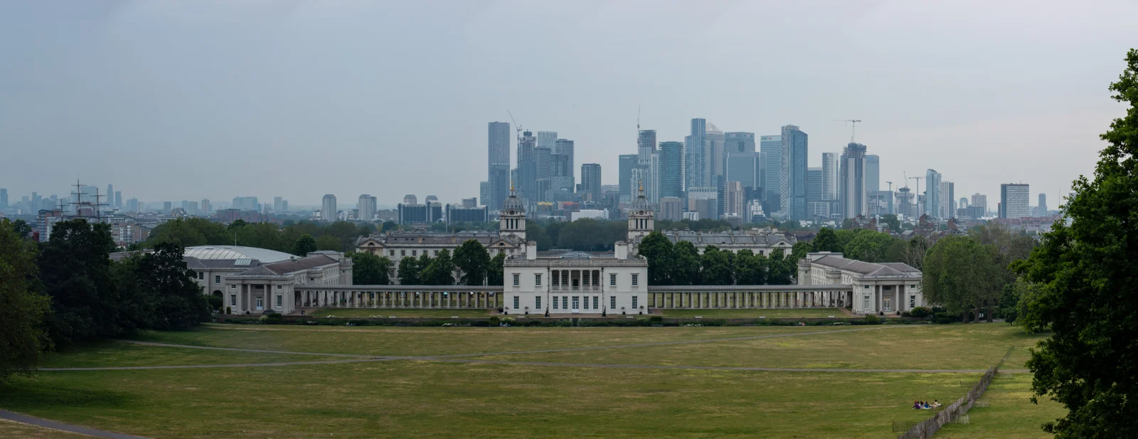
Canary Wharf connects this history with a Canadian story: the Reichmann family’s Toronto-based Olympia & York was central to its development. The DLR opened in 1987 and the Jubilee line extension followed in 1999, helping connect new workplaces and homes. Canada Water preserves another trading link: the former Canada Dock and Canadian timber. Follow the Canadian walk ↗ · West India Docks ↗ · TfL’s transport chronology ↗
Our existing briefing covers the development, its setbacks and the City’s wider financial history. The London Museum Docklands adds the earlier story of the port, including sugar and slavery.
Grosvenor in Mayfair and Belgravia, Cadogan in Chelsea, Portman in Marylebone and Bedford in Bloomsbury helped shape the streets and squares of Georgian and later London. Estate owners could retain the land while granting building leases, with developers constructing houses within agreed layouts and standards.
This helps explain coherent terraces, garden squares and the enduring role of estate ownership. It also connects the city’s appearance with its leasehold landscape, although leasehold itself has a much longer history.
For what this means when choosing a home, use CIL’s Renting & Buying guide.
New London Architecture: the great estates ↗ · Research: London’s landed estates ↗
The London County Council began in 1889. In 1965, the larger Greater London area and its 32 boroughs took shape, with the Greater London Council providing a citywide tier. The City of London retained its separate corporation.
The GLC was abolished in 1986. London regained an elected citywide tier in 2000 through the Mayor and Greater London Authority, including the London Assembly.
Today the boroughs provide many local services, while the Mayor and GLA handle strategic responsibilities. This helps explain why moving across a borough boundary can change local arrangements and council tax bills. London has 32 borough councils plus the City of London Corporation.
Parliament: London government history ↗ · City Hall: how London government works ↗
London’s green belt grew from interwar planning and land protection, strengthened through post-war policy. Its purpose includes containing sprawl and keeping neighbouring settlements from merging.
It helps explain the contrast between dense urban areas and protected open land beyond them. Housing debates turn on that balance: limiting outward development affects where homes can be built, alongside demand, transport, infrastructure and the use of existing urban land. There is no single explanation for London’s prices.
The 2012 Olympics and Paralympics accelerated the transformation of Stratford, with sporting venues, parkland and later development changing east London. The Shard was inaugurated in 2012, adding a new landmark beside London Bridge; its public viewing attraction opened the following year.
The Elizabeth line opened through central London in May 2022, with through-running and the full timetable introduced in stages. It changed the practical map of commuting again: connections and journey time can matter more than the distance between two postcodes.
Use the railway gateways guide when choosing a home →
The Shard: development history ↗ · TfL: the Elizabeth line opens ↗
Huguenot weavers helped shape Spitalfields; Jewish arrivals made the East End a centre of work and community institutions. Irish migration, Caribbean arrivals including the Windrush generation, and Bangladeshi communities around Brick Lane added further layers.
These histories overlap rather than neatly replacing one another. Workplaces, places of worship, shops, music and family networks give a neighbourhood its character. Our migration briefing follows these routes in more detail, including South Asian families arriving through East Africa.
What to spot on your next walk: warm brick, garden railings and the working life beneath the pavement.
The yellow-brown brick of many London terraces is London stock brick. Makers used brickearth, often mixed with town ash and cinders, and fired the bricks in large stacks called clamps. Brickfields supplied the growing capital from London and the wider south-east, including Kent and Essex.
The colour varies with materials and firing. Coal smoke and dirt later darkened many facades, concealing the warm tones beneath. Looking closely at the brickwork can reveal repairs, extensions and different phases of a house’s life.
Inigo Jones’s Covent Garden piazza of the 1630s helped establish the model of a planned London square. Bedford Square, built in the 1770s and 1780s, is a particularly coherent Georgian example.
The great estates used building leases to coordinate development while retaining land ownership. Developers built houses within agreed layouts and standards. Many square gardens remain private: the railings and residents’ keys are part of how these neighbourhoods work.
Covent Garden’s history ↗ · Historic England: Bedford Square ↗
The sunken space between a terrace and the pavement is an “area”, bringing light and access to basement rooms. Coal could be delivered straight into vaults through small openings in the pavement, avoiding a trip through the house.
Look for patterned round iron coal-hole covers, sometimes bearing the maker’s name. They are a surviving trace of the work needed to heat these homes. Street levels and construction methods varied, so a basement alone does not prove the road was raised.
Window tax encouraged some owners to block windows before its repeal in 1851. Other blank openings were designed for symmetry or altered for different reasons. A separate brick tax ran from 1784 to 1850.
These details turn an ordinary walk into a little architectural detective work. For the practical side of ownership, see CIL’s property guide.
The Monument stands 202 feet tall, the same distance as its location west of the place where the Great Fire began in Pudding Lane. Wren and Robert Hooke designed it. A familiar landmark becomes a small piece of the fire’s geography.
The river remains a force London has to manage. The Thames Barrier became operational in 1982, protecting the capital against tidal flooding. It continues the river-engineering story that includes Bazalgette’s sewers and embankments.
IRA bombings in the City in the early 1990s helped shape its security landscape, including the Ring of Steel. The separate 7 July 2005 attacks on public transport are commemorated by a memorial in Hyde Park, unveiled in 2009. These are histories of people and loss as well as changes to the streets.
The procession traces its roots to the early thirteenth century, when the City’s elected mayor had to travel to Westminster to pledge loyalty to the monarch. Today’s Lord Mayor of the City of London is a different office from the Mayor of London. That distinction brings the City and Westminster story back into the present.
Follow the official Roman trail, then notice medieval lanes, churches and modern towers sharing the same small area.
Roman London trail ↗Look at the embankment, bridges and river traffic. Each answers a practical problem as well as creating a view.
Understand the engineering ↗Start with the port’s history, then walk around the surviving dock basins and Canary Wharf. Read the old warehouses alongside the offices.
Plan a museum visit ↗For today’s housing decisions, use CIL’s Renting & Buying guide. This page explains the landscape behind those decisions.
Fictional families carry the story across generations, making the city’s long development easier to picture. Read it for an immersive sense of change; the factual briefings above use historical sources.
About the book ↗A thematic companion exploring the city’s character, places and recurring habits. A different way into London from a straight chronological timeline.
About the book ↗Eyewitness diary
A Londoner’s observations of the Great Fire and Restoration life. Start with the September 1666 entries.
Nonfiction
Bazalgette, sewage and the engineering that changed the Victorian capital. A companion to the river briefing above.
Historical fiction
Four Londoners’ intersecting lives during and after the Second World War, with the city’s damage and upheaval close at hand.
Fantasy
Police work meets magic in a London rich in neighbourhood detail. A playful way to notice the city’s geography.
Explore Britain’s migration histories, including Caribbean, South Asian and East African Asian communities, and the journeys from Britain to Canadian settlements and industries.
The City of London, often called the Square Mile, is the historic financial district around the Bank of England and the Stock Exchange. In conversation, “working in the City” can also mean working in finance. It does not mean all of central London.
Canary Wharf is a separate business district farther east in Tower Hamlets. The City’s Lord Mayor is also a different office from the Mayor of London.
Sources: City of London · London government
The Stock Exchange’s 1986 reforms ended fixed minimum commissions, opened membership to banks and financial institutions, and accelerated electronic trading. Overseas firms bought into established businesses. “Big Bang” is shorthand for this rapid change in how London’s markets worked.
It helps explain demand for different kinds of offices and trading space. It did not create London’s financial importance from nothing.
Sources: HMRC: what changed · London Stock Exchange history
Toronto-based Olympia & York, associated with the Reichmann family, developed Canary Wharf on former docklands. One Canada Square was built in the first phase in 1991 and became the district’s defining tower.
Olympia & York’s bankruptcy in 1992 shows that the development was not an uninterrupted success story. The estate later recovered. The DLR and the Jubilee line extension helped connect a new office district to the wider city; today the Elizabeth line adds another major connection.
On a visit, look at the surviving docks as well as the towers. The story connects trade, industrial decline, public regeneration, Canadian investment and transport. The nearby South Quay bombing is a separate chapter of human loss, remembered at the station memorial.
Sources: Institution of Civil Engineers: redevelopment · Canary Wharf: One Canada Square · South Quay memorial
Right to Buy changed council housing ownership. Docklands regeneration and financial-market reform changed where people worked. Abolishing the GLC in 1986 and creating the Greater London Authority in 2000 changed strategic government. Transport investment altered which homes could support a workable commute.
These are useful explanations for today’s skyline and housing debates, not a formula for predicting property prices. For practical decisions, connect this background with CIL’s housing guide and the railway gateway guide.
Sources: London government · Thatcher and Right to Buy